Location &
Contact
The hotel is set in landscaped gardens next to Malvern Priory and Gatehouse, now Malvern Museum.
The Abbey
Abbey Road
Great Malvern
Worcestershire
WR14 3ET
///riches.paint.shade
Give us a call on +44 1684 892 332 or email us at abbey@sarova.com
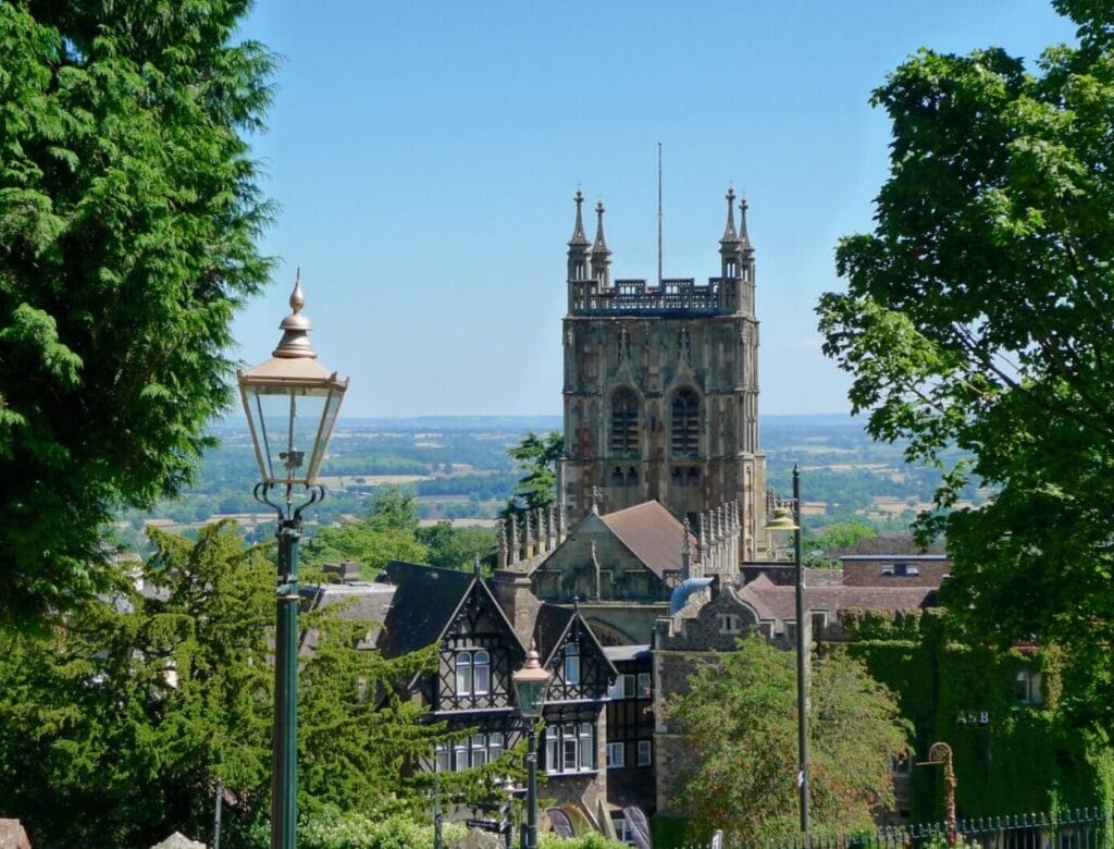
Historic spa town and theatre
Famed for its mineral-rich waters, the ancient spa town of Great Malvern holds numerous attractions including the Morgan Motor Company and Malvern Theatres. The famous Malvern College is a 10-minute walk.
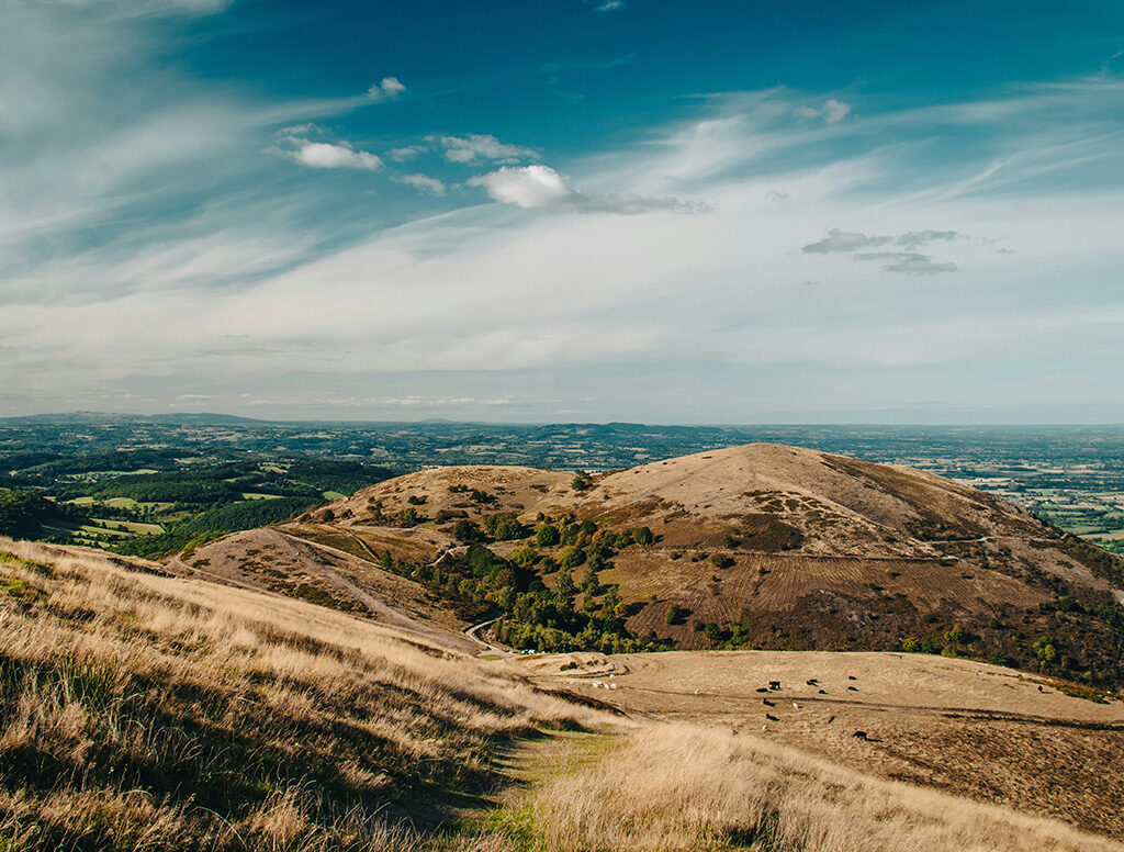
Walks in the Malvern Hills
A designated Area of Outstanding Natural Beauty with magnificent hiking trails, the Malvern Hills stretch across Worcestershire, Herefordshire and Gloucestershire.
We can prepare a packed lunch or point you to some good country pubs.
Questions
& Answers
Dogs are allowed in some bedrooms for £20 per night; please request this when making a booking. Only service animals are allowed indoors in public areas or where food is served.
If you'd like to dine with your dog, you may order from the Room Service menu to your bedroom.
Check out is until 11am. Late check out can be requested for a small fee but is not guaranteed.
Check in is from 3pm. Early check in can be requested for a small fee but is not guaranteed.
Priory View Lounge Bar is open between 12pm and 9.30pm daily. You may enjoy Afternoon Tea or dine from the All Day Dining menu.
Priory View Restaurant is open from 6pm, depending on availability. When the Restaurant is closed, our full menu is available in the Priory View Lounge Bar.
Yes! The Abbey serves Afternoon Tea daily from 12pm to 4pm.
Yes. We can provide maps for walks in the Malvern Hills. We can also arrange a packed lunch for your walk.
The Abbey has a large car park that is free for guests and visitors. Luggage can be dropped off at reception before parking.
Flexible reservations must be cancelled or amended no later than 12pm, the day before your scheduled arrival date to avoid a penalty charge of the first nights rate.
Prepaid reservations require a 100% non-refundable deposit at the time of booking and cannot be amended or cancelled once the reservation is confirmed. Credit cards will be charged for the full amount of your stay within 24hrs after making your reservation. You must be able to show the credit card used for the deposit at check-in, otherwise, you must be able to provide an official form of photo I.D. or provide an alternative method of payment.
To amend or cancel a reservation, please contact the hotel on 01684 892332 as Terms and Conditions can vary.
All current vacancies are listed online on our Careers pages.
No, e-scooters and e-bikes are not permitted anywhere on the hotel premises, including outside spaces, due to fire risks.
Some of our rooms can accommodate two adults and up to two children on a sofa bed, folding bed or travel cot. Please request this when making a booking.
For more information, view our family accommodation page.
Infants and Children aged up to 17, (maximum of 2 depending on the room type booked), are only charged a small supplement of £15.00 per day. Guests aged 18 and above are considered adults, sofa beds and extra beds are not supplied for adults, we recommend reserving an additional room when booking accommodation for more than two adults.
Yes. The Abbey hosts many Christmas events every year, including Christmas Parties, Festive Lunches and Dinners, Christmas Afternoon Tea, Christmas Residential Packages, and New Year’s Eve events. For more information on Christmas at The Abbey, call us on 01684 892332.
No, we don’t have a loyalty programme, but offer a number of benefits for booking directly with the hotel including a free drink of you choice to enjoy during your stay.
Call our reception team as soon as possible to let us know. We will do our best to return any lost property as soon as possible.
Yes. Two rooms at The Abbey are adapted for guests with disabilities. Public areas, the restaurant, bar and all meeting rooms except the Elgar Suite are step free. We also offer two parking spaces for Blue Badge holders, have an accessible public toilet, and lift access to all floors. Click here for full details of our accessible facilities.
Sarova Hotels has partnered with AccessAble to develop Accessibility Guides, offering comprehensive information for guests requiring accessibility assistance.
Yes. Menus detailing allergens are available on request. Please advise the waiting staff of any food allergies.
Event
Enquiry
We are gathering your personal data to provide you with a better service. For a full description on how we process and keep safe your personal data please see our Privacy Notice at privacy.sarova.com. You can also request a printed version of this document from reception or by emailing privacy@sarova.com. If you prefer not to be contacted by us, please tell reception that you wish to opt of future communications or email privacy@sarova.com.